

Massif Central
Section 5 of the Trans-European Alpine Route
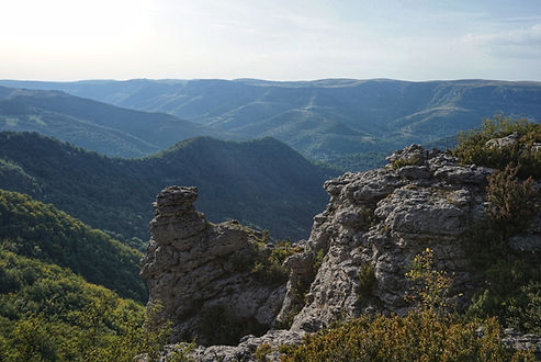
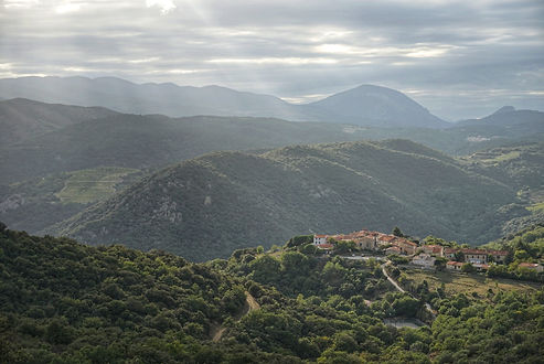
After leaving the Alps and crossing the Rhone river valley the route takes us up onto the Massif Central and traverses the Cevennes Mountains before dropping into French wine country and arriving at the foothills of the Pyrenees. A combination of long-established GR hiking routes wind for over 600km through forests, canyons, mountains, and villages before dropping south towards the Spanish border.
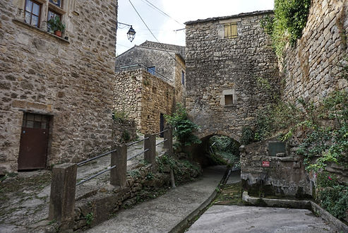
Elevations are much lower than the Alps and the terrain is much more forgiving. You can cover some serious ground through this section, but don't let the old world charm go unnoticed as you pass through centuries-old mountain towns and rural communities.
GPS Notes: The track shown here was created digitally, not recorded myself. Digital resources and tracks for France have been quite accurate.
Export GPX Files: Click the Fullscreen button (top tight), then in the Legend (left), then click on the three dots beside the map title and select Download KML. I suggest downloading only one layer at a time, so that the files will be organized into separate layers when you import them into your offline navigation app.
Main Route
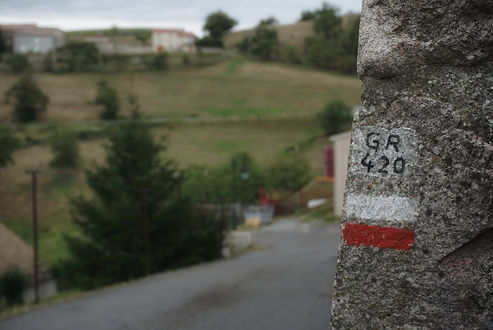
The main trail used here is the GR7, which traverses the Massif Central atop the divide between the Mediterranean and Atlantic watersheds. The GR420 is used first to reach the GR7, which eventually transitions to the GR77 and then the GR36 and some of its variations. It's not uncommon for several GR routes to share sections of trail, so pay attention at intersections when multiple paths may be blazed red and white. Forest roads are the most common tread through the region, and even paved road walks won't be uncommon. They usually don't last too long.

Alternate Routes
Although there are other GR trails in the area, I think the main route here is ideal and I've only included a single alternate which cuts a corner and saves a few km.

Resupply
See the resupply spreadsheet for details. Distances are very manageable, with no stretches more than 4 days apart if you're moving well.
Threaded fuel canisters will be easiest to find at the beginning and end of the section (gear stores in Valence and Perpignan are accessible from the trail by bus).
Water
The public piped springs and faucets in the many villages you'll be passing through make water sources much more frequent than they would be from surface sources alone. There are some water carries up to 20km to keep an eye out for, but otherwise it's not bad.

Huts / Shelters
Very few. I've included campgrounds near the trail since they're the cheapest and easiest way to shower and do some laundry. Be warned! Many campgrounds in France expect you to bring your own soap and therefore there is none in the bathrooms, not even by the sink. If you're planning to get cleaned up at a campground you'll want to grab soap/shampoo with your resupply.
Borders / Transportation / Other
Mont d'Ardeche Regional Nature Park is the only area that explicitly prohibits wild camping and bivouac. The trail passes through the park from roughly km 21 to km 108. Plan to stay in Vernoux-en-Vivarais (~km 26, with a municipal campground) and then hike ~38km to Le Cheylard (Camping Le Cheylard), then finally hike 44km to clear the park boundary and bivouac in a pine forest.
Cevennes National Park allows a bivouac between 7pm and 9am within 50m of GR trails, which is all a TEAR hiker needs.

Next Section: The Pyrenees