The Balkan Gap
Section 2 of the Trans-European Alpine Route
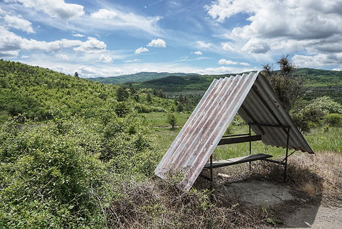
There are two 'gaps' to speak of here - the gap in between the Balkan Mountains and the Dinaric Alps, and the gap in established trail infrastructure between the Kom-Emine and the Via Dinarica. That does not mean that this section is a flat road walk. The route passes over the northwesternmost extent of the Rila-Rhodopes mountains and the northern reaches of the Sharr Mountains, including Kosovo's Sharr Mountain National Park. The path mostly follows high elevation forest roads and will often feel similar to the Kom-Emine, minus the blazes and huts. This is by far the longest gap without established trails on the TEAR.
GPS Notes: This section especially has been walked in different ways by past TEAR hikers. Be sure to download all the alternates and read the navigational notes in the waypoints.
Export GPX Files: Click the Fullscreen button (top tight), then in the Legend (left), then click on the three dots beside the map title and select Download KML. I suggest downloading only one layer at a time, so that the files will be organized into separate layers when you import them into your offline navigation app.
Main Route
Although this section doesn't use local trail systems, most of the main path has been hiked and is feasible. The exception is the stretch through North Macedonia, which is significantly different than the path that was tested in 2019. Unless there is some unexpected problem with the new route, it should be a huge improvement.


Alternate Routes
There are several alternates throughout this section. Some will be weather/condition dependant (the ridge before Dragoman and the huge ridge through Sharr Mountains National Park), while others are possible improvements to the route that haven't been tried yet. The early detour into Serbia looks like a no-brainer to me, so someone hike it! The extensions to the existing ridgewalk in Serbia also look good, but one of them bypasses a resupply.


Resupply
Resupplies are kept short for the entire section, but may be affected by which alternates you choose to take. The schedule given on the resupply spreadsheet only follows the current main route.
Again, there are no places along the trail to buy a threaded fuel canister. You can take a train to Sofia from Dragoman or from the train station just before the Serbian border on the Dmitrovgrad alternate. Skopje (Macedonia) also has gear stores, but there isn't a convenient way to get there from the trail using public transportation. Denatured alcohol may tricky to find as well since the resupply towns are quite small until you reach Kosovo.
Water
Water sources are fairly regular except for the untested ridge walk across North Macedonia. There very well may be a piped spring or two along the way, but until it's confirmed you'll need to prepare for a potential ~50km water carry. There's also a potential ~30km dry stretch before Gjakova, Kosovo (ended up filtering some lovely puddle water there in 2019, but carrying a bit extra is probably a nicer option).


Huts / Shelters
None that I found. You'll have to rely on accommodations in the towns you pass through. There are hostels in Prizren (Kosovo) and affordable hotels in Dragoman (Bulgaria), Dmitrovgrad (Serbia), Gjakova (Kosovo), and Bajram Curri (Albania). There are guesthouses scattered about as well. Airbnb is a great option but relies on an internet connection (getting individual SIM cards for each country through this section would be difficult). It's probably a good idea to stay as presentable as possible for the sake of the border crossings throughout this section.
Borders / Transportation / Other
The most important topic here is the border crossings. They regularly force the route onto paved roads but there's no getting around it. As long as you are from a country whose citizens are allowed to enter into Serbia, North Macedonia, Kosovo, and Albania without applying for a visa, these crossings are a simple affair. You're just passing through like everyone else, except that you aren't in a vehicle. Provide your passport and be prepared to answer questions about the purpose of your visit, where you came from and where you're headed, and how long you expect to be in the country. Knowing the names of the last town you were in, the next town ahead, or the names of the nature areas you're about to explore will be helpful.


Next Section: Dinaric Alps
